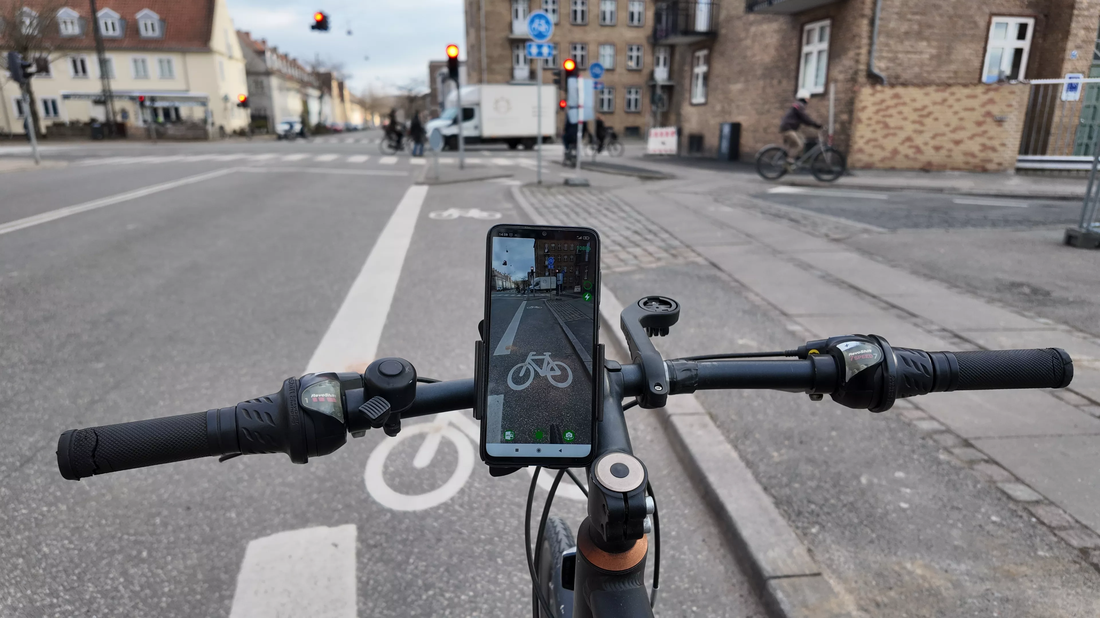
Capture
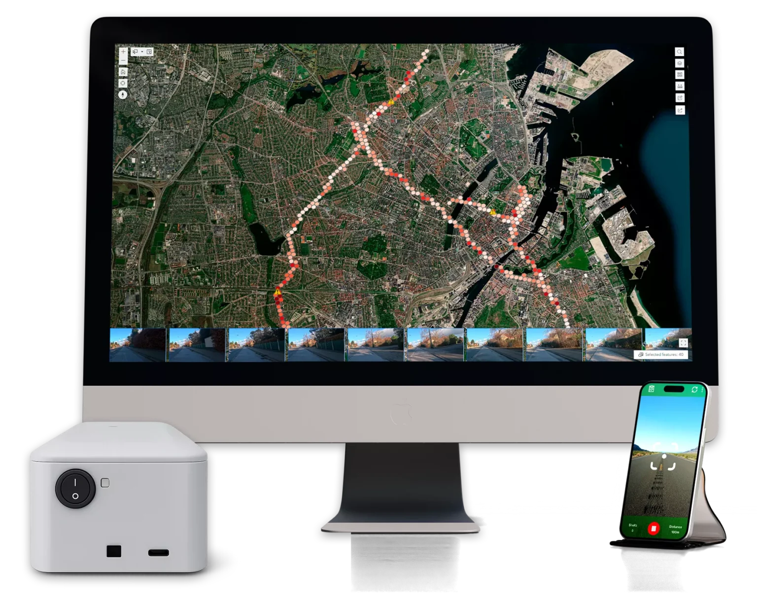
Mount your smartphone to record HD imagery and sensor data while traveling on roads or cycle lanes.

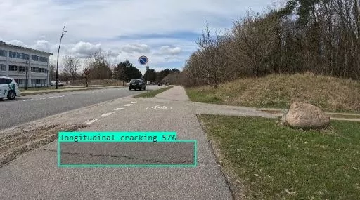
Compute
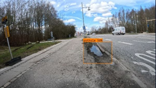
Cloud AI processes imagery, combines positioning data, and automatically detects issues like potholes and cracks.
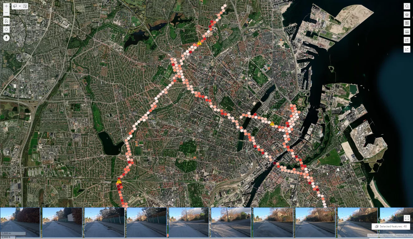
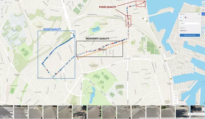
Decide
Within minutes, insights appear in the ROAD SYSTEM 365 dashboard, ready for budgeting and contractor work orders.