AI-Powered Road Assessment Using Your Smartphone

Capture HD imagery and sensor data while driving or cycling. Our AI automatically detects potholes, cracks, and surface defects, then delivers precise location data with sub-meter GPS accuracy. All from your phone—no expensive hardware needed.

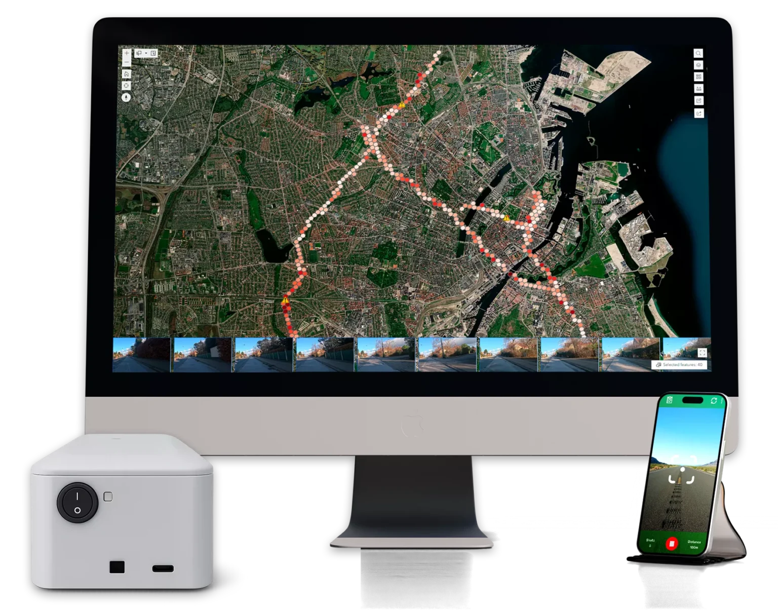
ROAD SYSTEM Platform Dashboard

How ROAD SYSTEM™ Works

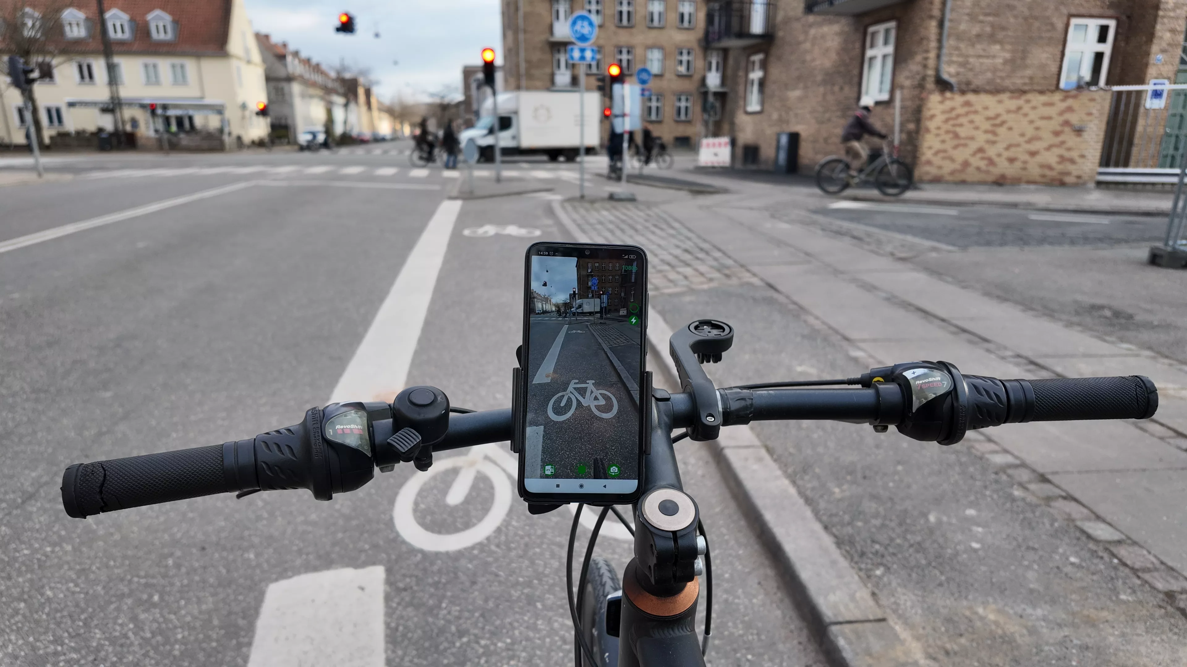
Capture

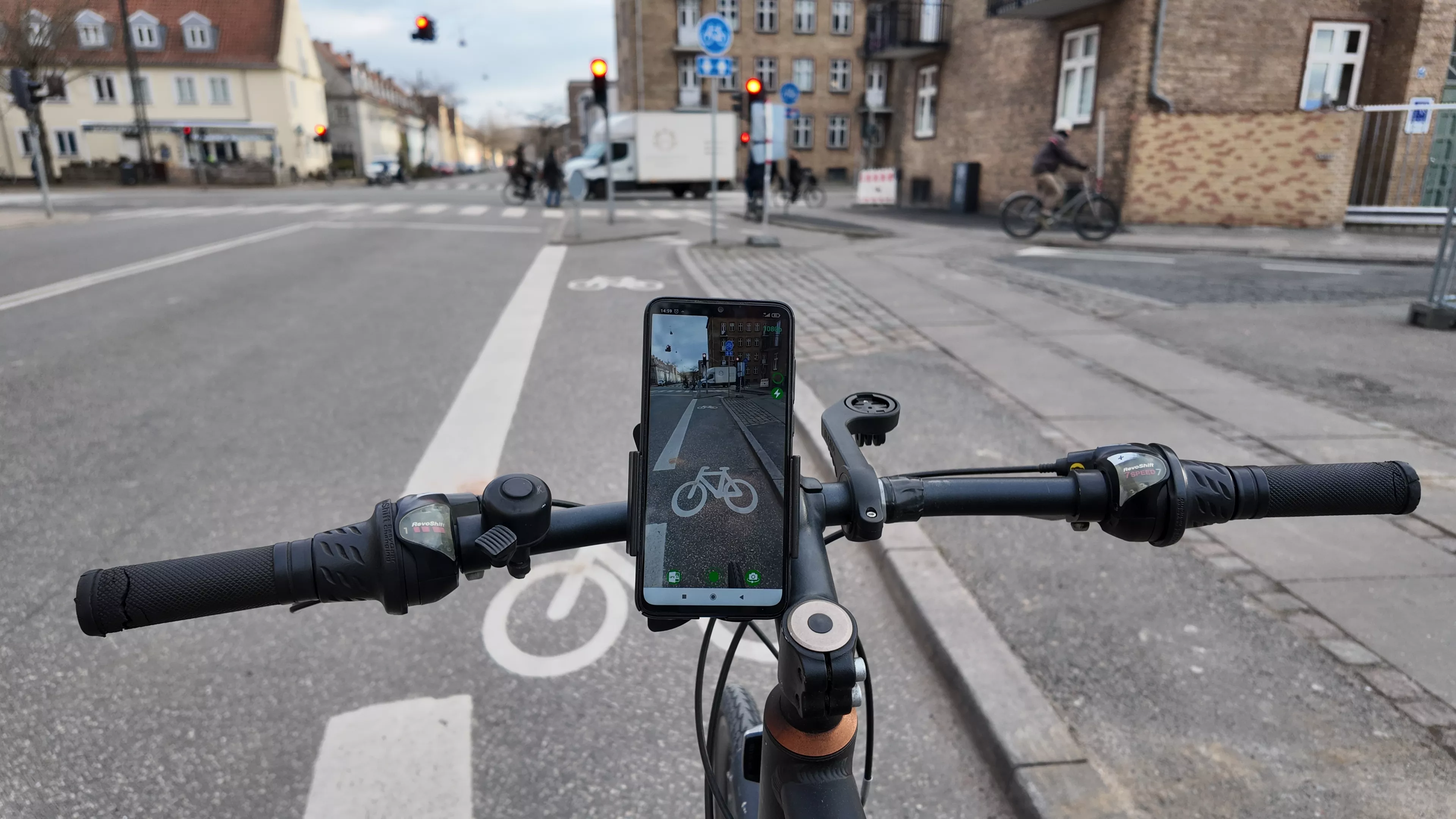
Mount your smartphone to record HD imagery and sensor data while traveling on roads or cycle lanes.
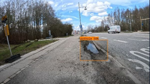
Compute

Cloud AI processes imagery, combines positioning data, and automatically detects issues like potholes and cracks.
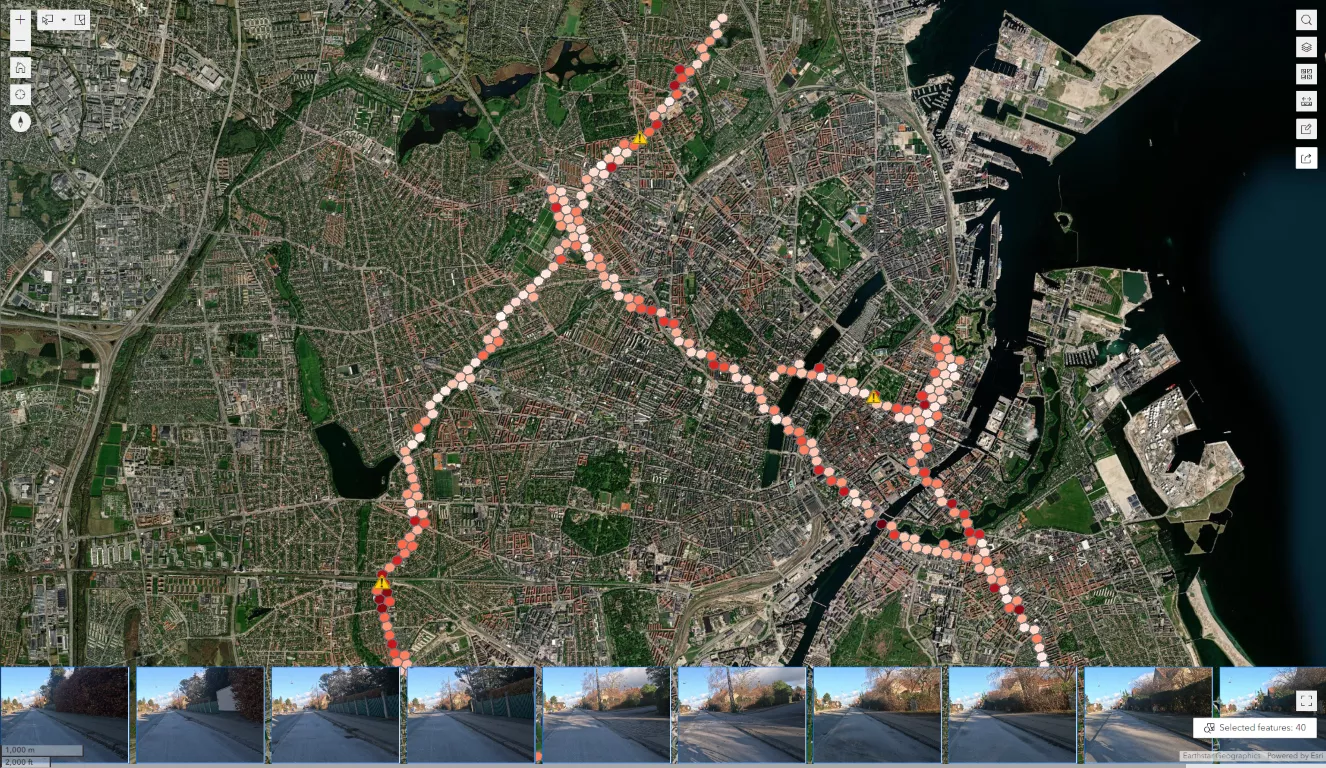
Decide

Within minutes, insights appear in the ROAD SYSTEM 365 dashboard, ready for budgeting and contractor work orders.
Trusted by Leading Organizations

We Build Denmark
ESA BIC Denmark
EIT Urban Mobility

Transform infrastructure assessment with ROAD SYSTEM™

Capture infrastructure data using smartphones, process with AI for automatic defect detection, and make data-driven maintenance decisions with comprehensive GIS dashboards.

Capture HD imagery and sensor data with your smartphone

Mount your smartphone on any vehicle or bicycle to record high-resolution imagery and sensor data while traveling. GNSS positioning provides sub-meter accuracy for precise issue location.

Learn about data collection

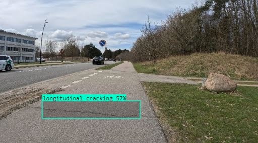
Automatic detection of potholes, cracks, and surface defects

Cloud-based AI processes imagery and automatically detects and classifies road surface issues with >80% accuracy. Identifies transverse cracks, longitudinal cracks, alligator cracking, and potholes.

Explore AI features

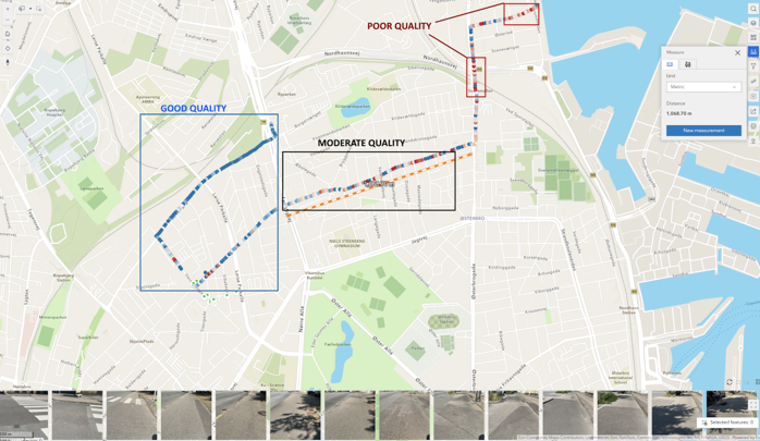
Interactive GIS dashboard with heat maps and analytics

Visualize infrastructure condition network-wide with heat maps, zoom to street-level detail, filter by defect type or location, and track progress over time. Export data in multiple formats.

View dashboard features

Export reports and integrate with existing systems

Generate PDF reports, CSV files, and GIS formats (Shapefile, GeoJSON, KML). Integrate via RESTful API or OGC Services (WMS, WMTS, WCS, WFS) with your existing asset management systems.

See integration options

Key Features of ROAD SYSTEM™

feature-icon

AI-Powered Detection

Automatic detection of potholes, cracks, and surface defects with >80% accuracy.

feature-icon

Sub-Meter GPS Accuracy

GNSS positioning with Galileo and GPS for precise issue location (0.5-1m accuracy).

feature-icon

Interactive Dashboard

GIS dashboard with heat maps, street-level detail, and export capabilities.

feature-icon

Cost-Effective

80% cost reduction compared to traditional methods at €15 per kilometer.

feature-icon

API Integration

RESTful API and OGC Services for seamless integration with existing GIS systems.

feature-icon

Privacy & Compliance

GDPR & CCPA compliant with automatic anonymization and secure data handling.

Simple, scalable pricing

Starter

Small municipalities / local contractors

up to 100 km network

€4,900

/ year
€15/km
Contact SalesNo credit card required
ProfessionalPopular

Mid-size cities or regional operators

up to 1000 km network

€9,900

/ year
€9/km
Contact SalesNo credit card required
Enterprise

Provinces / large contractors

> 1000 km network

€25,900

/ year
€5/km
Contact SalesNo credit card required

Frequently asked questions!

  • What is ROAD SYSTEM™ Mobile App?

    ROAD SYSTEM™ Mobile App is an AI-powered platform for road and cycle lane infrastructure assessment. It uses smartphone sensors and GNSS positioning to capture data, processes it through cloud-based AI, and delivers actionable insights through an interactive GIS dashboard.

  • How accurate is the GPS positioning?
  • What is the AI classification accuracy?
  • How much does ROAD SYSTEM™ cost?
  • Is ROAD SYSTEM™ GDPR-compliant?
  • What devices are supported?
  • Can I integrate ROAD SYSTEM™ with my existing GIS systems?
  • How long does data processing take?