ROAD SYSTEM™ Platform Features
Discover comprehensive features for AI-powered road infrastructure assessment. From automated defect detection to interactive GIS dashboards, ROAD SYSTEM™ delivers everything you need for professional infrastructure management.

Mobile Data Collection
Mount your smartphone to record HD imagery and sensor data while traveling on roads or cycle lanes. Cross-platform iOS and Android app with offline capability.
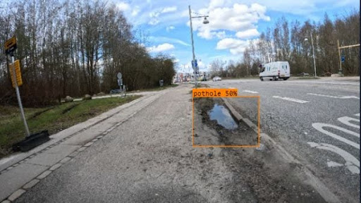
AI-Powered Defect Detection
Cloud AI processes imagery and automatically detects issues like potholes, transverse cracks, longitudinal cracks, and alligator cracking with >80% classification accuracy.
Sub-Meter GPS Accuracy
GNSS positioning with Galileo and GPS for sub-meter accuracy (0.5-1m typical). Multi-constellation support ensures reliable positioning even in challenging environments.
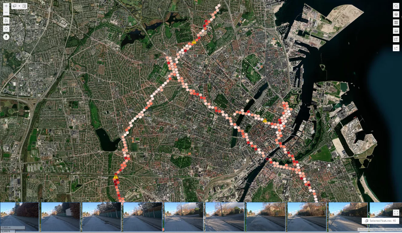
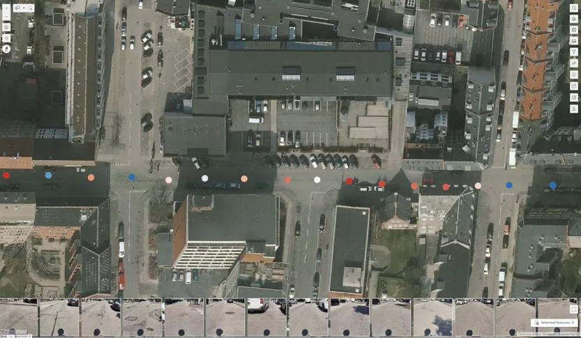
Interactive GIS Dashboard
ROAD SYSTEM 365 dashboard provides heat maps, street-level detail, defect counts, risk scores, and comprehensive analytics for data-driven decision-making.
Export & Integration
Export data in multiple formats (PDF, CSV, Shapefile, GeoJSON, KML, GeoPackage, FGDB). RESTful API and OGC Services for seamless integration with existing GIS systems.

Privacy & Compliance
GDPR & CCPA compliant with automatic face anonymization and license plate blurring. Secure data handling, encrypted transmission, and full data ownership for customers.
Everything you need for infrastructure assessment
Mobile App
Cross-platform iOS and Android app for easy data collection using existing smartphones.
AI-Powered Detection
Automatic detection of potholes and cracks with >80% classification accuracy.
GNSS Positioning
Sub-meter GPS accuracy using Galileo and GPS for precise issue location.
Interactive Dashboard
GIS dashboard with heat maps, street-level detail, and comprehensive analytics.
API Integration
RESTful API and OGC Services for seamless integration with existing GIS systems.
Export & Reporting
Export data in multiple formats: PDF, CSV, Shapefile, GeoJSON, KML, and more.